Sold2019Pomerania Central Europe Antique MapDucatus Pomeraniae. Hand-colored engraved map. J.B. Homann, Nuremberg, 18th C.. 21" x 24".See Sold Price
Sold2020AN ANTIQUE MAP, "Europe (Evrop)," JOHN SPEED,AN ANTIQUE MAP, "Europe (Evrop)," JOHN SPEED, CARTOGRAPHER, 1626-1676, hand-colored engraving on paper, Abraham Goos (1589-1643), engraver, published for merchants Thomas Basset and Richard Chiswell iSee Sold Price
Sold2024Antique Europe Map/ France. Pieced down in sections. Sight size 26-1/2 x 36 inches. Overall framedAntique Europe Map/ France. Pieced down in sections. Sight size 26-1/2 x 36 inches. Overall framed size is 32 x 42 inchesSee Sold Price
Sold2021de Fer, Nicolas 1717 Antique Map. Europe"L'Europe Suivant les Nouvelles Observations" Copper Engraved Map Published 1717, Paris for "Introduction a la Geographie" by Nicolas de Fer. Folds as issued. Paper Size: 14 x 10 inch (36 x 25cm) GoodSee Sold Price
Sold2018Blaeu: Antique Map of Europe, 1650Title/Content of Map: Highly decorative Map by Blaeu Date Printed: c1650 Cartographer: W. Blaeu Material/Medium: Paper Size: 19" x 24" Hand colored engraved Map. French text on Verso. Magnificent examSee Sold Price
Sold2021Eleven Antique Maps of EuropeEleven Antique Maps of Europe , 16th-18th c., incl. Ptolemy from 1541 (4); a Blaeu map of "Regno di Napoli", Hondius map of the Holy Land, de Wit map of Southern Spain, an undated manuscript map of MeSee Sold Price
Sold2017Homann Heirs: Antique Map of Europe, 1746Map: Europe ** Nuremberg?? Date Printed: 1746 Cartographer: Homann Heirs Material/Medium: Paper Size: 21" x 23 1/4" Nuremberg. Hand colored copperplate engraved. Beautiful baroque style cartouche. PleSee Sold Price
Sold2023Antique Map Print - Europe - Spain and Portugal - Madrid - Lisbon - VaugondyTitle: Antique Map Print - Europe - Spain and Portugal - Madrid - Lisbon - Vaugondy Date/Period: 1806 Dimensions: 31,5 cm x 24 cm Material: Paper Additional Information: Original 1806 copper-engravedSee Sold Price
Sold2018Seutter: Antique Map of Europe, 1740Title/Content of Map: Europe by Seutter Date Printed: c1740 Cartographer: Matthaus Seutter Material/Medium: Paper Size: 19" x 23" Original hand colored copperplate engraved. Published in Augsburg. PubSee Sold Price
Sold2023Antique Map Print - Europe - Map of Ancient Sicily - Italy - Philipp CluverTitle: Antique Map Print - Europe - Map of Ancient Sicily - Italy - Philipp Cluver Date: 1701 Material: Paper Dimensions: 15 cm x 13 cm Description: A detailed small map from ”Introductionis inSee Sold Price
Sold2022L'Europa divisa ne'suoi principali stati. Europe. ZATTA 1779 old antique mapTITLE/CONTENT OF MAP: 'L'Europa divisa ne'suoi principali stati' Europe divided into its main states DATE PRINTED: Published in 1779. Engraved in 1777 (this date is printed on the map). IMAGE SIZE: ApSee Sold Price
Sold2017Moll: Antique Map of Europe & the Near East. 1736Map: Antique map of Europe and the Near East. 1736 Date Printed: 1736 Cartographer: Moll, Herman Size: 10 x 8 inches Outline hand color Condition: Very Good. Strong impression and platemark. On chain-See Sold Price
Sold2018Levasseur: Antique Map of Europe, 1852Title/Content of Map: 1852 Levasseur Map of Europe -- Europe Date Printed: 1852, Paris Cartographer: V. Levasseur Size: 11.5 x 17 in. Very decorative map of Europe. The surrounding engravings frame thSee Sold Price
Sold2017Levasseur: Antique Map of Europe, 1861Map: 1861 Levasseur Map of Europe -- Europe Date Printed: 1861 Paris Cartographer: V. Levasseur Size: 11.5 x 17 in. Condition: Very good, slight toning on edge, nicely colored. Very decorative map ofSee Sold Price
Sold2020Antique Map of Europe Glued on a CanvasAntique Map of Europe Glued on a Canvas. Beautifully Framed. Condition: Generally good. Dimensions: Sight- 36"x27", Frame- 43"x34". Provenance from a Long Island NY Estate. Please note the absence ofSee Sold Price
Sold2017Sidney Hall: Antique Map of Europe, 1830Map: Europe Publication Date: 1830 Authors: LONGMAN, REES, ORME, BROWN AND GREEN, HALL, SIDNEY Publisher: LONGMAN, REES, ORME, BROWN AND GREEN Size: Folio – 16.25 H x 20.00 W Inches Polar projectionSee Sold Price
Sold20231769 ANTIQUE MAP of EUROPE framed EUROPEAN POSTAL ROADS & STATIONS1769 ANTIQUE MAP: MAPPA GEOGRAPHICA EXHIBENS POSTAS omnes tam vehiculares quam verdarias Totius Germaniae cum earum accurata distantia Diligentissime propriis sumptibus excudit. Aug. Vindelicor. : TobSee Sold Price
Sold2017Russell: Antique Map of Europe, 1799Map: Europe, Drawn from the Best Authorities... Publication Date: 1799-04-07 Authors: C. DILLY/G.G. & J. ROBINSON, RUSSELL, J./RUSSELL JR. Publisher: C. DILLY/G.G. & J. ROBINSON Size: Folio – 15.25See Sold Price
Sold2017Homann: Antique Map of SouthEast Europe, 1753Title/Content of Map: 1753 Homann Map os the Danube and SouthEast Europe -- Fluviorum in Europa principis Danubii cum adiacentibus Regnis nec non totius Graeciae et Archipelagi Novissima Tabula Date PSee Sold Price
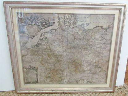
Sold2018Bonne: Antique Map of Central Europe, 1780Title/Content of Map: 'L'Allemagne, La Boheme, et La Hongrie; avec une partie de Pologne'. A map of Central Europe from the Baltic Sea to the Gulf of Venice, including present day Germany, Poland, CzeSee Sold Price
Sold2024L'Europa. Europe. DE ROSSI 1677 old antique vintage map plan chartTITLE/CONTENT OF MAP: L'Europa [Europe] DATE PRINTED: 1677 IMAGE SIZE: Approx 44.0 x 56.5cm, 17.25 x 22.25 inches (Large) TYPE: Antique 17th century folio atlas map CONDITION: Good; suitable for framiSee Sold Price
Sold2023Early 19th century "Europe" by John Thomson 1817 old antique map plan chartTITLE/CONTENT OF MAP: 'Europe' DATE PRINTED: Published in 1817 IMAGE SIZE: Approx 49.0 x 56.5cm, 19.25 x 22.25 inches (Large); Please note that this is a folding map. TYPE: Antique early 19th centurySee Sold Price
Sold2017Mitchell: Antique Political Map of Europe, 1867Map: Map of Europe, showing its Gt. Political Divisions Cartographer: S. A. Mitchell Place & Date: Philadelphia / 1867/1870 Size: 13 1/4" x 10 7/8" Condition: full color; light overall age toning TheSee Sold Price
Sold2017Neele: Antique Map of Turkey in Europe, 1783Map: The Southern & Middle Parts of Turkey in Europe. Publication Date: 1783-06-01 Authors: T. STACKHOUSE, NEELE, S. J. Publisher: T. STACKHOUSE Size: Quarto – 15.00 H x 14.25 W Inches Outline map oSee Sold Price
6 days LeftTrillium Antique Prints & Rare BooksDe Jode, Rare, pub. 1593 - Map of Europe (Nova Totius Europae Tabula)$120(3 bids)
Featured3 days LeftJasper52Europe's Overland & Sea Communications with Asia. Chart. LARGE 1959 old map$35
3 days LeftJasper52Europe. Russie #17 Ural River Southern Russia Kazakhstan. VANDERMAELEN 1827 map$50
Featured2 days LeftJasper521738 RUSSIA SIBERIA & GREAT TARTARY Description illustrated ANTIQUE in ENGLISH$950
2 days LeftJasper521704 DESCRIPTION OF ALL THE SEATS OF THE PRESENT WARS OF EUROPE antique w/ MAPS$260


![L'Europa. Europe. DE ROSSI 1677 old antique vintage map plan chart: TITLE/CONTENT OF MAP: L'Europa [Europe] DATE PRINTED: 1677 IMAGE SIZE: Approx 44.0 x 56.5cm, 17.25 x 22.25 inches (Large) TYPE: Antique 17th century folio atlas map CONDITION: Good; suitable for frami](https://p1.liveauctioneers.com/5584/322790/173578184_1_x.jpg?height=310&quality=70&version=1710881198)


